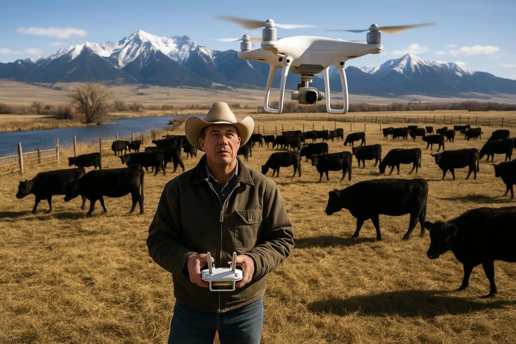
On a good year in Montana, you can drive a section line and feel like the crop is doing fine—until harvest proves otherwise. On a tough year, you might already know where the wheels are wobbling, but pinning down exactly why can be the hard part. That’s where modern aerial imagery is trying to earn its keep: not as a shiny gadget, but as a faster way to see patterns across a whole field before problems become expensive.
A growing slice of the precision ag world is focused on turning aerial photos into practical maps—showing where plants are stressed, where stands are thin, and where water, insects, disease, or nutrient issues may be taking a bite. Companies in this space often combine high-resolution images with software that flags areas worth walking. Reports indicate some systems are also working toward more automated identification of problem “signatures,” though ground-truthing is still essential.
Why aerial imagery matters in big Montana country
Montana agriculture covers a lot of acres, often spread out and managed with lean crews. When you’re balancing seeding, spraying, haying, livestock, and a weather forecast that can change its mind by lunch, scouting every acre the old-fashioned way is tough.
Aerial imagery—captured by plane, drone, or satellite—can help by:
- Showing variability you can’t see from the road. Subtle differences in vigor, canopy cover, or color can stand out from above.
- Helping prioritize scouting. Instead of walking a whole pivot or section, you can head straight to “hot spots.”
- Supporting targeted decisions. Variable-rate fertilizer, spot spraying, or adjusting irrigation sets can start with a better map.
- Documenting conditions. Imagery can help record hail damage, flooding, wind events, or stand loss for internal records and, in some cases, insurance conversations.
It’s not a silver bullet. Aerial tools don’t replace a shovel, a hand lens, or a phone call to your agronomist. But they can shorten the time between “something’s off” and “here’s where to look.”
What’s changing: sharper images and smarter processing
Producers have had access to satellite imagery for years, and it can be useful—especially for broad trends. But satellites can be limited by cloud cover, revisit timing, and resolution. Drones can capture very detailed images, but they take time, require a pilot, and can be tricky in wind.
That’s why some companies are leaning into aircraft-based imaging paired with proprietary processing. The pitch is straightforward: fly at the right altitude, capture consistent data, and run it through software that turns raw photos into field-ready layers.
Depending on the provider and sensor package, outputs may include:
- High-resolution RGB imagery for stand counts, washouts, lodged areas, and visible damage
- Vegetation indices (often NDVI-style products) to highlight plant vigor differences
- Zone maps for variable-rate applications
- Change detection comparing one flight to another
Some services report they can deliver results quickly after a flight, which matters when you’re deciding whether to replant, re-spray, or shift inputs. It’s worth asking how fast “fast” really is in your area, and what the service level agreement looks like during peak season.
What aerial maps can (and can’t) tell you
A clean map is only as useful as the decision it supports. Aerial imagery is strongest at showing where something is happening. It’s less definitive about what is causing it without boots on the ground.
Common “what it might be” examples:
- Patchy low vigor: compaction, nutrient deficiency, root disease, herbicide carryover, or poor emergence
- Linear patterns: equipment overlap, plugged drill runs, sprayer misses, or irrigation issues
- Edge effects: wildlife pressure, drift, salinity, or drainage differences
That’s why most agronomists will tell you the same thing: use imagery to guide scouting, then confirm with soil tests, tissue tests, and field observations. If a platform claims it can identify a specific disease or nutrient issue from imagery alone, treat that as a starting hypothesis—not a diagnosis.
Where this fits alongside satellites, drones, and boots-on-the-ground
Montana producers are practical. The best tool is the one that works on your acres, your timeline, and your budget. Here’s a plain-language way to think about the options:
- Satellite: broad coverage, often cheaper, but resolution and clouds can be limiting.
- Drone: very detailed and flexible, but takes time and favorable conditions; may require licensing and planning.
- Manned aircraft imaging: can cover a lot of acres quickly with consistent resolution, but depends on provider availability and cost structure.
- Scouting: still the truth serum; imagery works best when it points your boots to the right spots.
If you’re exploring imagery, it’s smart to ask whether data layers can be exported into your existing tools (John Deere Operations Center, Climate FieldView, Trimble, Ag Leader, etc.). Compatibility and ownership matter as much as image quality.
Questions to ask before you pay for flights or subscriptions
Not every operation needs another dashboard. Before signing up, consider asking providers:
- What resolution will I actually get? And is it consistent across the whole field?
- How often can you capture imagery? Weekly? After key growth stages? On-demand?
- What’s the turnaround time? Especially during peak season.
- How do you handle clouds, smoke, and haze? Montana summers can bring all three.
- Who owns the data? Can you export it if you leave?
- What does it integrate with? Can it create shapefiles/prescriptions for your equipment?
- What kind of support do you provide? A map is only helpful if someone can explain it.
It’s also worth running a small pilot: one or two fields with known variability, compared against your own yield maps and scouting notes. If the imagery consistently points you to the right problems, it’s earning value.
What this means for Montana
Montana’s scale is both an advantage and a challenge. When you’re farming thousands of acres of wheat, barley, pulses, sugar beets, or hay—or managing mixed ground with cattle in the rotation—small inefficiencies add up fast. Better aerial imagery won’t change the weather, but it can help you respond to it.
Here are a few Montana-specific ways improved aerial scouting could matter:
- Drought triage: When moisture is short, identifying which zones are holding on can help prioritize limited inputs or irrigation timing.
- Hail and wind documentation: Storm tracks can be narrow and ugly. High-resolution images may help map damage and guide harvest planning.
- Weed escapes: Spotting patches early can support targeted follow-up, potentially reducing whole-field re-sprays.
- Irrigation performance: On pivots and wheel lines, imagery can highlight nozzle issues or distribution problems before yield loss is locked in.
- Grazing and hay decisions: For operations balancing forage and row crops, aerial views can help estimate biomass differences and plan cutting or grazing rotations.
Montana also has unique realities: wildfire smoke, long travel distances, and short windows to act. Any imagery service that can deliver consistent, timely data—without creating more busywork—has a better chance of sticking.
Getting started: practical next steps
If you’re curious but not ready to commit, a few low-risk steps can help:
- Compare free or low-cost satellite layers with your yield maps and scouting notes.
- Talk with your agronomist or crop consultant about which imagery products they trust and can interpret.
- Check guidance from MSU Extension on soil testing, nutrient management, and troubleshooting field variability.
- If you fly drones, review FAA requirements at faa.gov/uas.
Precision ag works best when it’s tied to a decision: a variable-rate plan, a replant call, a spray adjustment, or a harvest strategy. Aerial imagery is simply another way to see your acres clearly—especially when the season is moving faster than your pickup can.
Inspiration: www.agdaily.com
Leave a Reply