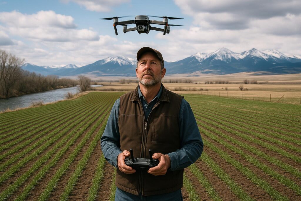
On a Montana farm, you can do a lot with a pickup, a shovel, and a good set of boots. But when you’re covering thousands of acres—or trying to keep a close eye on a few hundred under tight labor and time constraints—there’s a point where walking every corner just isn’t realistic. That’s where aerial imagery has been steadily moving from “nice to have” to “serious tool,” especially as more growers look for ways to make scouting more targeted and inputs more precise.
Recent reporting in ag media highlights companies working to modernize how aerial agricultural imagery is captured and processed, aiming to make field maps more actionable and easier to interpret. While individual product claims can vary and should be evaluated carefully, the broader trend is clear: better imagery, delivered faster, can help growers identify problem spots sooner and verify whether a management change actually worked.
From “pretty pictures” to practical decisions
Aerial images of fields aren’t new. Many Montana producers have used satellite layers, drone flights, or airplane-based photos for years. What’s changing is the push toward imagery that’s less about producing a high-resolution snapshot and more about delivering a usable diagnosis: where the field is off, how severe it might be, and what to check on the ground.
In practice, the best imagery systems are the ones that help answer questions like:
- Where should I scout first? Instead of zig-zagging a whole pivot, you can head straight to the areas that look stressed.
- Is this pattern agronomic or mechanical? A streak that follows a boom width may point to sprayer issues; a ring could suggest irrigation distribution problems.
- Did the fix work? After a fertility adjustment, irrigation repair, or weed control pass, imagery can help confirm recovery—or show that the issue is still expanding.
That’s especially relevant when you’re balancing fertilizer costs, herbicide resistance concerns, and the reality that a lot of Montana’s growing season decisions happen fast.
How aerial imagery can reveal what your windshield can’t
Even experienced eyes can miss subtle stress early on. Crop issues often start small and spread. Aerial imagery—whether color (RGB) or multispectral—can highlight differences in canopy vigor that aren’t obvious from the road.
Common problems that imagery may help flag include:
- Moisture stress from uneven irrigation, plugged nozzles, or soil variability.
- Nutrient deficiencies that show up as patchy vigor or striping.
- Weed pressure in missed strips, corners, or along field edges.
- Stand issues from emergence problems, crusting, or residue-related variability.
- Disease hotspots that may expand in a pattern tied to moisture, wind, or canopy density.
Imagery doesn’t replace agronomy. It’s a pointer, not a verdict. The value comes when it shortens the time between “something’s wrong” and “here’s what’s actually happening,” because you still need boots on the ground to confirm the cause.
Airplane, drone, or satellite? Picking what fits
Montana operations are diverse: dryland wheat and pulse crops, irrigated alfalfa and corn, sugar beets in some regions, plus specialty crops and seed production. The right imagery platform depends on scale, timing, and how quickly you need answers.
- Satellite imagery is widely available and can be cost-effective, but cloud cover and revisit timing can limit usefulness during critical windows.
- Drones can deliver very high detail and on-demand flights, but require time, expertise, and favorable wind conditions—no small ask on the Highline or in open valleys.
- Manned aircraft imagery can cover large acreages quickly and may provide consistent results, though availability and scheduling can vary by region and season.
Some newer services emphasize improved processing workflows and calibration methods intended to make images more consistent across flights and lighting conditions. Reports indicate that certain providers are also working on proprietary approaches to highlight “problem areas” more clearly, which could reduce the time it takes to interpret maps and turn them into a scouting plan.
Turning imagery into action: the real payoff
A map is only useful if it changes a decision. For Montana growers, the practical wins often come down to three things: saving time, sharpening inputs, and documenting outcomes.
- Targeted scouting: If imagery narrows your field check from 1,200 acres to three 40-acre zones, that’s real labor savings.
- Smarter applications: Imagery can support variable-rate decisions where equipment and prescriptions make sense, or it can simply help you avoid blanket “insurance” passes.
- Better records: When you can compare imagery before and after a change—like a nozzle repair, a fertility trial strip, or a different herbicide program—you build a season-to-season knowledge base.
If you’re already using tools like yield maps, soil sampling layers, or guidance lines, imagery can be another piece of the puzzle. If you’re not, it can still stand alone as a way to prioritize where you spend your limited time.
Questions to ask before you pay for a service
Not all imagery products are equal, and Montana conditions can be unforgiving. Before signing on, it’s worth asking a few direct questions:
- How often can you capture my fields? Weekly might be ideal, but timing around key growth stages may matter more than a fixed schedule.
- What happens when it’s smoky or cloudy? Wildfire smoke and summer storms can affect capture windows and image clarity.
- How is the imagery calibrated? Consistency matters if you’re comparing one date to another.
- Can I export data? Look for compatibility with common farm software and file formats if you plan to build prescriptions.
- What support is included? A map without interpretation can become just another folder on your desktop.
Also consider data privacy and ownership. Many platforms now store imagery in the cloud. Make sure you understand who can access it and how it may be used.
What this means for Montana
Montana agriculture often runs on big distances and narrow windows. When the wind lays down, you spray. When the pivot quits, you fix it now. When a dry spell hits, you make hard decisions about water and inputs. In that context, improved aerial imagery isn’t about fancy tech for its own sake—it’s about reducing uncertainty.
Here are a few Montana-specific angles where better imagery could matter:
- Covering large acreages efficiently: Many operations simply can’t scout everything by foot as often as they’d like.
- Managing irrigation variability: In irrigated valleys, imagery can help spot distribution issues early—before yield takes a hit.
- Responding to weather swings: From late frosts to heat spikes, aerial snapshots can help quantify damage and recovery.
- Supporting trials and conservation practices: Whether you’re testing a new variety, adjusting seeding rates, or changing residue management, imagery can help document results across a whole field, not just a few flagged spots.
For producers who are curious but cautious, a sensible approach is to start small: pick one or two fields, one season, and a clear goal (like catching irrigation issues or evaluating a fertility change). If the imagery consistently saves time or improves decisions, scaling up becomes an easier call.
Where to learn more
If you want to compare imagery options or understand how remote sensing fits into agronomy, a couple of practical starting points include:
- Montana State University Extension resources: https://extension.montana.edu/
- USDA Climate and crop-related tools (useful context alongside imagery): https://www.usda.gov/
The bottom line: aerial imagery won’t fix a field by itself, but clearer, more timely maps can help Montana growers find issues sooner, verify what’s working, and spend their time where it counts.
Inspiration: www.agdaily.com
Leave a Reply